30 Minutes SHARED Helicopter Tour in Honolulu

REVIEW · OAHU HELICOPTER & DOORS-OFF FLIGHTS

30 Minutes SHARED Helicopter Tour in Honolulu

5.0 · 27 reviews 30 minutes (approx.) From $319 Operated by Honolulu Helicopter Tours · Bookable on Viator
Book on Viator →

Oahu from the air hits different. In about 30 minutes, this small-group shared helicopter ride puts you above Honolulu’s coastline, neighborhoods, and landmarks.

I especially like the maximum 3 travelers setup, because the trip stays personal instead of feeling like cattle. I also like the pilot commentary, since it gives quick context for what you are actually looking at.

The main drawback to consider is simple timing: it is short, so you will see a lot, but you will not linger over any one spot for long. Weather matters too, because the tour requires good conditions.

Key things to know before you go

  • Max 3 travelers per flight keeps this feeling like a close-in experience, not a big group scramble.
  • Pilot commentary adds context while you fly over landmarks like Diamond Head and Punchbowl Crater.
  • A route that links Waikiki, harbors, freeways, and memorial sites means you get variety, fast.
  • You will get aviation headsets and a cellphone lanyard, so you can focus on the view instead of gear.
  • The ride is weather-dependent, so have a flexible day on your Oahu schedule.

A 30-minute helicopter loop: why it works so well in Honolulu

30 Minutes SHARED Helicopter Tour in Honolulu - A 30-minute helicopter loop: why it works so well in Honolulu
If your Oahu time is tight, this kind of short flight is a smart use of it. You are not trying to “see the whole island,” you are getting the big wow factor quickly, from the angle the ground can never match. In a shared setup, you also get access to that aerial perspective without the price jumping into private-tour territory.

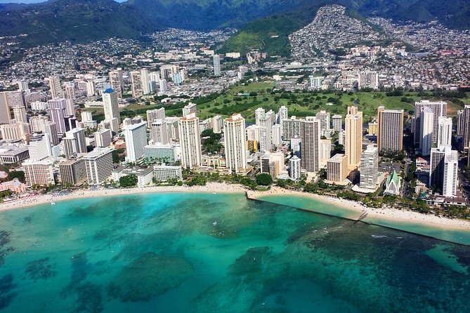
What makes it feel special is the mix of “easy to recognize” sights and “how did they even get that from the ground?” details. From above, Waikiki looks like a pattern of beaches, high-rises, and harbors. Meanwhile, places like Punchbowl and Moanalua Gardens read as distinct, mapped landscapes, not just names on signs.

The value is also in the experience shape. You are in the air for about 30 minutes, not half a day. That means you can pair it with a normal day plan for the rest of your trip, whether you are dining in town or doing beach time.

More Oahu tours and island experiences worth comparing

The flight route in plain language, from HNL out over Oahu

Your tour starts and ends at HNL (Honolulu International Airport), then loops across central Oahu. Along the way, you should expect views over Sand Island, Honolulu Harbor, Ala Moana Beach Park, Magic Island, and Ala Wai Harbor.

From there, the route moves toward the coastlines and landmarks that make Honolulu famous, including Waikiki and Diamond Head. Then you keep sliding across the city and surrounding areas, with aerial looks that include Honolulu downtown and the National Memorial Cemetery of the Pacific at Punchbowl Crater.

The last stretch is where the trip becomes “Oahu, not just Honolulu.” You will pass over parts of the road network and neighborhood zones, including the Moanalua Gardens area and the H-3 highway region, plus spots like Black Point sea pools and Aloha Stadium. It is a lot of variety for one short flight.

Coastal icons first: Sand Island, Honolulu Harbor, and Ala Moana to Magic Island

30 Minutes SHARED Helicopter Tour in Honolulu - Coastal icons first: Sand Island, Honolulu Harbor, and Ala Moana to Magic Island
Early on, you get the coastline and harbor geography that defines the city. Sand Island and Honolulu Harbor give you a sense of how shipping, tourism, and oceanfront life sit side-by-side. From above, you can spot the working-pier layout and see how the harbor edges shape the water inlets.

Then you move to Ala Moana Beach Park, a long stretch of sandy shoreline between Waikiki and downtown. From the air, that half-mile-plus view is easy to understand as a real corridor, not just a park you walk through. If you like photos, this is often one of the easiest places to frame because you get sand, surf, and coastline all in one shot.

Just adjacent, Magic Island adds another layer. It is a small man-made peninsula next to Ala Moana and the Ala Wai harbor area. In helicopter view, it reads as a neat geometric break in the shoreline, and it helps you understand how the bay and marina areas connect.

Ala Wai Harbor rounds out this first section. It sits between Waikiki and downtown, and from above you can trace the relationship between the harbor, the canal, and the built-up resort zone. It is one of those “now I get it” views where the city suddenly makes sense.

Waikiki and Diamond Head from above: how to spot the shape of the island

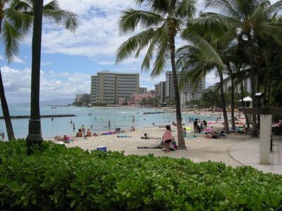
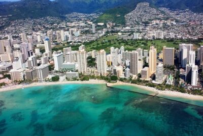
When the flight turns toward Waikiki and Diamond Head, you will get the kind of iconic aerial view people dream about. Waikiki is a dense cluster of high-rise hotels along the shore, with the beach area and Waikiki Aquarium zone down below. From the air, you can see the shoreline curve and how the resort core sits tightly against the ocean.

Diamond Head is more than a famous backdrop. It is a volcanic tuff cone, known to Hawaiians as Lēʻahi. From above, the ridge shape and the way the slopes funnel toward the coast make it easier to understand why it is such a recognizable silhouette from so many angles.

If you like taking photos, plan for brief “best moment” windows. Because your flight is short, you will not get unlimited passes over each landmark. I would focus on catching Diamond Head with Waikiki in the same frame when the timing lines up, because that combo tells the full Honolulu story fast.

Waialae Country Club, downtown, and Aloha Tower: the city grid with meaning

As you keep moving, you may pass over areas that feel different from the beach strip. Waialae Country Club is one example. It is a private club area in East Honolulu, and from above it reads as manicured land that stands out against the more public coastline zones.

Then you reach Honolulu downtown, where skyscrapers and major landmarks cluster. One point of interest is Iolani Palace, which stands out for its role as a restored royal residence. From the air, you might also spot the Aloha Tower Marketplace waterfront area and the Aloha Tower itself, which dates to the 1920s.

This part is valuable because it shows you Honolulu as a layered city, not just resort neighborhoods. The helicopter view turns the downtown core into a map, helping you orient later on the ground. It also makes it easier to understand where the harbor zone sits relative to the financial and government areas.

A quick practical note: city views are great in daylight, but they can be visually busy. If your goal is pure “one postcard,” lean toward framing coastal spots. If your goal is understanding the city, downtown is where the puzzle pieces snap together.

Here's some more things to do in Oahu

Punchbowl Crater: seeing the memorial landscape as a single place

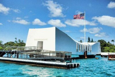
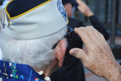
Punchbowl Crater is one of the most affecting landmarks on the route. The National Memorial Cemetery of the Pacific sits inside the crater area, serving as a national cemetery honoring those who served. From the air, the setting matters. You can see the bowl-like geography as one unified space, which helps it register more clearly than a street-level view might.

This is also where the helicopter tour feels unusually respectful. You are not just sightseeing, you are viewing a place with significance. Even from above, it comes across as a defined and intentional landscape.

The trade-off is also real. Because it is a short flight, you are not spending long enough to absorb details the way you would on the ground. If you have a strong interest in memorial history, plan to pair this with some ground time later. The aerial view works best as context, not as a complete substitute.

Moanalua Gardens: quieter, greener structure in the middle of Oahu

Moanalua Gardens is another stop that adds variety beyond beaches and city blocks. It is a 24-acre privately owned public park, and it includes the Kamehameha V Cottage area. There is also the Prince Lot Hula Festival connection, plus notable tree coverage, including a famous large monkeypod tree often referenced as the Hitachi tree.

From above, this kind of park reads as a breath of organized greenery inside an urban system. It is not just “green.” It is a shaped park space that stands out against surrounding development. If you are the kind of traveler who likes seeing how Oahu’s land use patterns change from coast to inland, this stop delivers.

One consideration: you will still be moving quickly. If you want to photograph the garden layout specifically, watch for the pass that gives you clearer angles, then be ready to capture quickly. The helicopter is fast, and your best photo window may only be moments.

H-3 freeway, tunnels, and the sea pools: how infrastructure becomes scenery

30 Minutes SHARED Helicopter Tour in Honolulu - H-3 freeway, tunnels, and the sea pools: how infrastructure becomes scenery
Not every memorable view is a landmark with a name on it. A big part of this route includes aerial looks at the island’s infrastructure, and that is where the trip can surprise you.

You may see parts of the Moanalua Freeway designation and major roadway intersections like H201 Interchange. Then you get the H-3 highway region, also known as the John A. Burns Freeway, crossing the Ko’olau Range. The route is described as including several viaducts and tunnels, including the Tetsuo Harano Tunnels and the smaller Hospital Rock Tunnels.

From above, you can see how those tunnels and elevated stretches break up the landscape into layers. It turns the engineering into something visual, not just a commute line. For many people, this is the moment the helicopter tour stops feeling like a sightseeing loop and starts feeling like a real aerial understanding of the island.

On the other side of the road-and-rail vibe, Black Point sea pools bring you back to ocean texture. This kind of coastline detail can look almost abstract from above. It is the opposite of Waikiki’s crowded shoreline, and it gives you a sense of how varied Oahu’s water edges can be.

Finally, Aloha Stadium offers another perspective, especially if you know the area from the ground. It is simply another “big recognizable” object in the aerial map.

Small-group vibe and pilot moments: how to get more from your seat

Your flight is built for an intimate feel, with a maximum of three travelers. That matters because you will usually have less chaos around boarding, less waiting in a crowd, and a more conversational vibe in the air. It also helps the pilot commentary land better, since there is more chance for questions or focused explanations.

The pilot experience is a highlight. Names that come up include Scott and Stefan, and one guide mentioned is Jacob. The consistent theme is friendly, professional guidance, with pilots helping passengers understand what they are seeing and keeping things smooth and safe from takeoff to landing.

If your goal is photos, pay attention to door options if they are offered. One of the top tips is flying with the doors off, since that can improve how you frame shots and how clear your camera angles feel. I would treat this as a request you make rather than a guarantee, but it is worth asking before you go.

Also, since the tour includes aviation headsets and a cellphone lanyard, you can plan light. Keep your phone secure and be ready to switch between listening and shooting when the views line up.

Price and value: what $319 buys you on a short, high-impact flight

At $319 per person for about 30 minutes, you are paying for speed, views, and access to angles that boats and buses simply cannot provide. A helicopter is not cheap. The question is whether the value matches your priorities.

Here is the practical way I would judge it: if you want beach photos and skyline photos, a shorter flight can still be worth it because it delivers the iconic angles without taking over your entire day. If you want a broad “Oahu in one experience” feeling, this route covers a lot of ground in a compact timeframe, from harbors to Diamond Head to inland landmarks like Punchbowl and Moanalua.

The shared format is part of the value equation. You are not paying a full private charter price, and you still get a max-three-group setup. That combination is often what makes the difference between a helicopter ride that feels reasonable and one that feels like a splurge you regret.

If you are budget-stretching, check whether you are traveling as one person or pairing with friends, since group discounts are mentioned. If you are traveling solo, you may still find it worth it if you are highly motivated by aerial views and want a once-in-a-trip highlight.

Who should book this shared helicopter tour, and who should skip it

This tour is a strong match for people who:

  • Want big views in a short window.
  • Love photography and want higher-angle pictures of Waikiki, Diamond Head, and Honolulu’s harbor areas.
  • Like a guided experience with pilot context instead of just random sightseeing.

It is not the best match if you:

  • Need long time over one single landmark, because the total flight time is about 30 minutes.
  • Get frustrated by weather-based plans, since the tour requires good weather.

If you are traveling with kids, the small-group feel can be easier to manage, and the pilot commentary can turn the flight into a mini lesson about Oahu. If you are an older traveler, the seat time is short, but make sure you match the stated 300 lbs total weight per passenger limit.

Quick decision: should you book this 30-minute flight?

I think you should book this if you want a real Oahu highlight with minimal time spent commuting or waiting around, and you care about seeing the island from above. The route is packed, the group is tiny, and the pilot experience seems to be a core part of why people love it.

Skip it if your top priority is slow travel and in-depth time at a single site. This ride gives you context and photos, not extended exploration. If you are choosing between options, treat this helicopter tour as your “aerial day,” then let your ground time go deeper where it matters most.

FAQ

How long is the 30-minute shared helicopter tour?

It’s approximately 30 minutes.

How many people are on the helicopter?

This activity has a maximum of 3 travelers.

Where do we meet for the tour?

The meeting point is 1 Lagoon Dr, Honolulu, HI 96819, USA. The tour ends back at the meeting point.

What’s included with the ticket?

You get aviation headsets and a cellphone lanyard.

Is there a weight limit?

Yes. The total weight per passenger is 300 lbs.

What is the cancellation policy if weather or timing changes?

You can cancel for a full refund up to 24 hours in advance. The tour requires good weather, so if it’s canceled due to poor weather, you’ll be offered a different date or a full refund. If the minimum number of travelers is not met, you’ll also be offered a different date or a full refund.